
Publisher Note
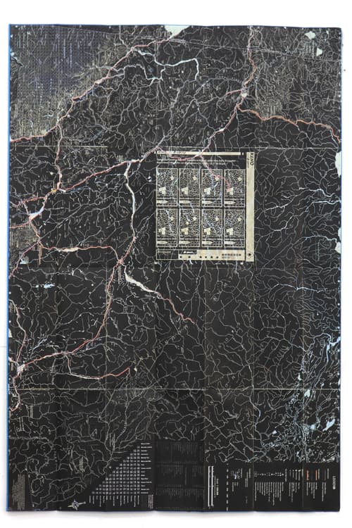
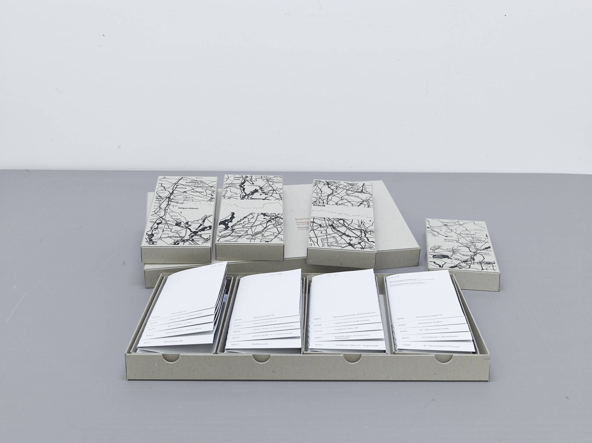
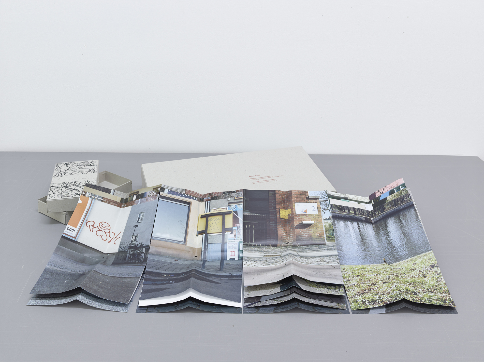
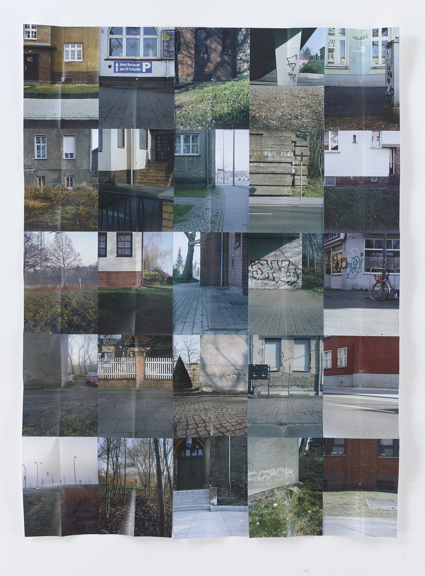
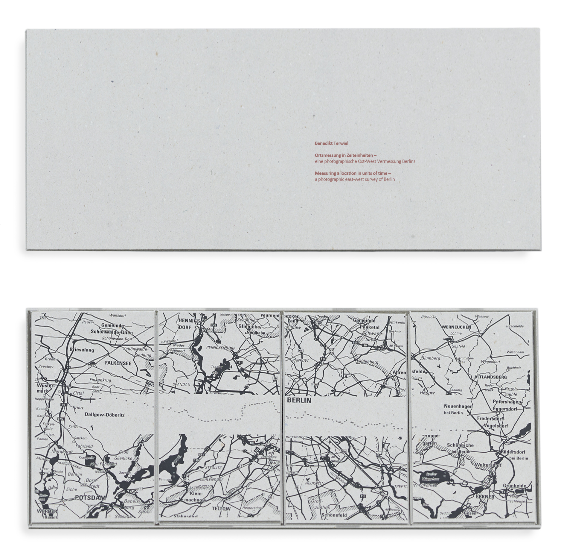
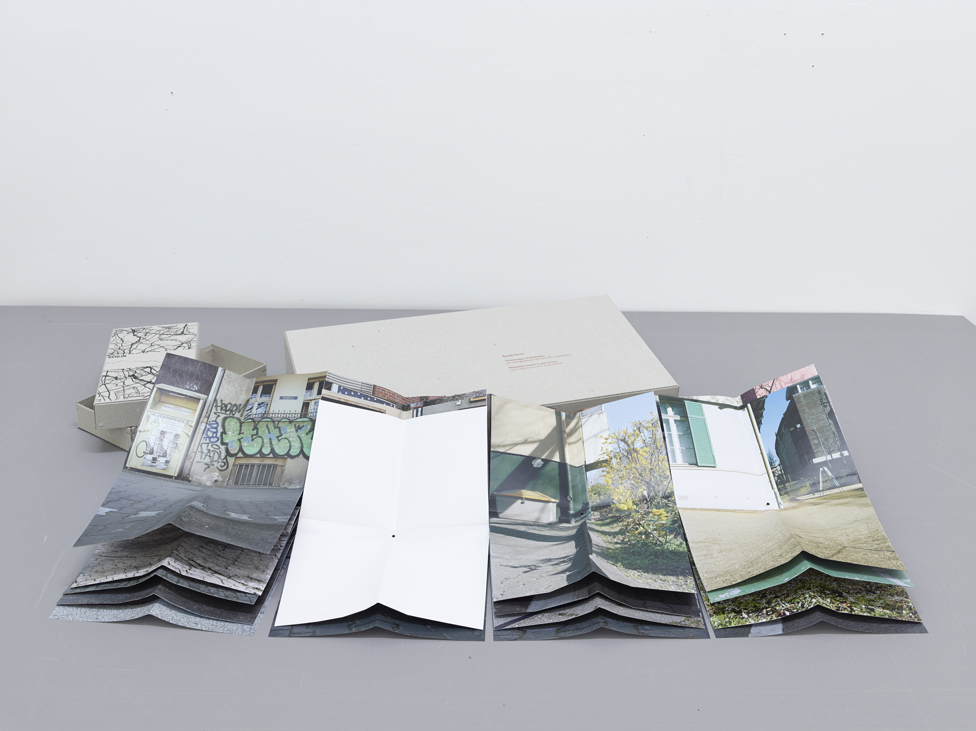
The four parts of the map Measuring a Location in Units of Time depict a 50-km measuring route across Berlin. It begins on a measuring rod in a field east of the city and ends at one close to a highway just past its western border. It roughly intersects the suburban areas of the former East with its small, semirural houses and continues along the monumental Stalinist boulevard leading to Alexanderplatz. From there, the route passes Prussian imperial monuments such as the Brandenburg Gate and the Reichstag and then traverses the dense intercity industrial working-class district of Moabit, the bourgeois neighborhood Charlottenburg, and the large villas in Westend before finally arriving to the postwar social housing on the city’s western outskirts.
The camera replaces the measuring tool to produce images of a concrete spatial situation in lieu of numeric coordinates. But as in the measuring/bearing process, the space between the photographed points remains invisible so that the resulting map does not provide viewers with a geographical overview. On the contrary, they are left with only a sequence of locations constrained by temporal and spatial limitations. Beginning at its most eastern point at 6:20 am in the morning to the last point at 7:20 pm in the West, these locations map a one-day journey by foot from sunset to sundown.
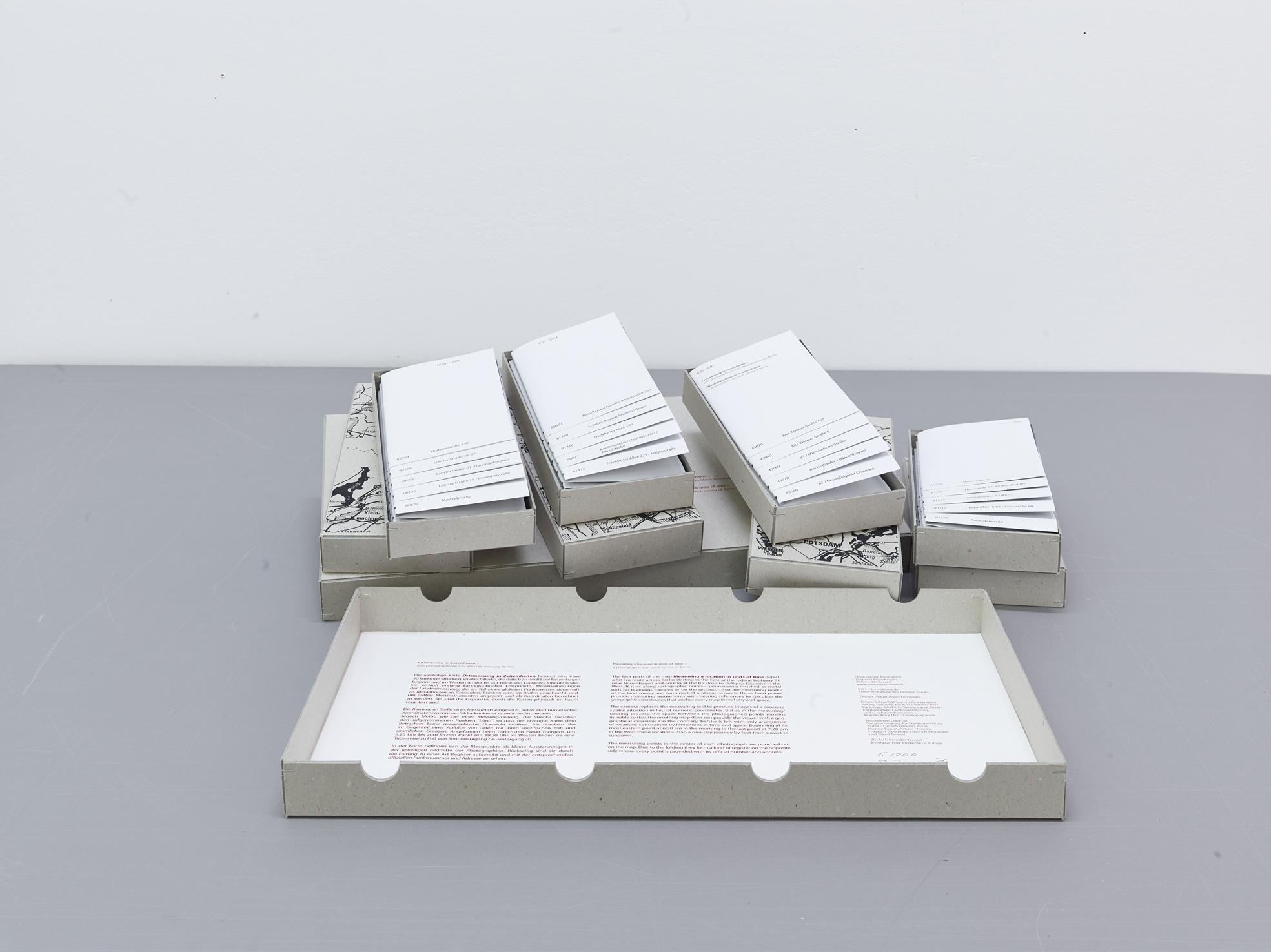
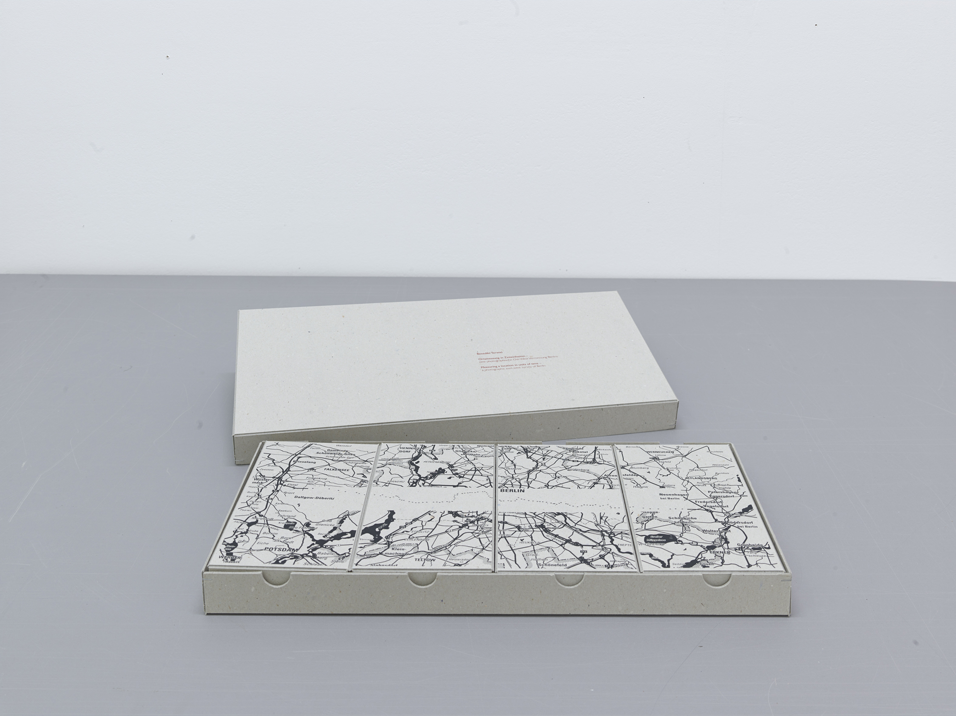
The measuring points in the center of each photograph are punched out on the map, which is then folded so that they form a register on the opposite side where every point is provided with its official number and address. The folding technique allows users to find their way around the plan without fully unfolding it. Although the plan is printed on a single sheet, one can peruse it in all directions and display and combine different locations through different folding configurations. This reflects the geometric survey measuring between the different points.
The special folding and cutting of the edition is borrowed from the so-called Falk Plan developed in 1945 by Gerhard Falk. As the story goes, he developed this plan when he tried to find his way around the ruins of postwar Hamburg. His maps were manually folded (as is this edition) until the 1990s.
Ortsmessung in Zeiteinheiten / Measuring a location in units of time
— eine photographische Ost-West Vermessung Berlins / a photographic east-west survey of Berlin
by Benedikt Terwiel
| Publisher | self-published |
|---|---|
| Release Place | Berlin, Germany |
| Edition | 1st edition |
| Release Date | 2014 |
| Credits |
Artist:
|
| Printrun | 200 |
| Inscription | numbered, signed |
| Original Price | 280.00 EUR |
| Work | |
|---|---|
| Subform | Folding Map |
| Genre/Content Form | City Map |
| Topics | Berlin, City, Land Survey, Maps, Urban Landscape |
| Methods | Analog Photography, Photography |
| Object | |
|---|---|
| Dimensions | 45.0 × 22.0 × 4.0 cm |
| Interior | |
|---|---|
| Technique | Color Offset |
Web references
Artist Website