Publisher Note
The purpose of the Atlas of Natural Regions (ARN) is to create a photographic archive documenting the great diversity - but also their progressive standardization - of the landscapes and more particularly of the buildings that we find on French territory. Started in 2017, it is expected to be completed in 2024.
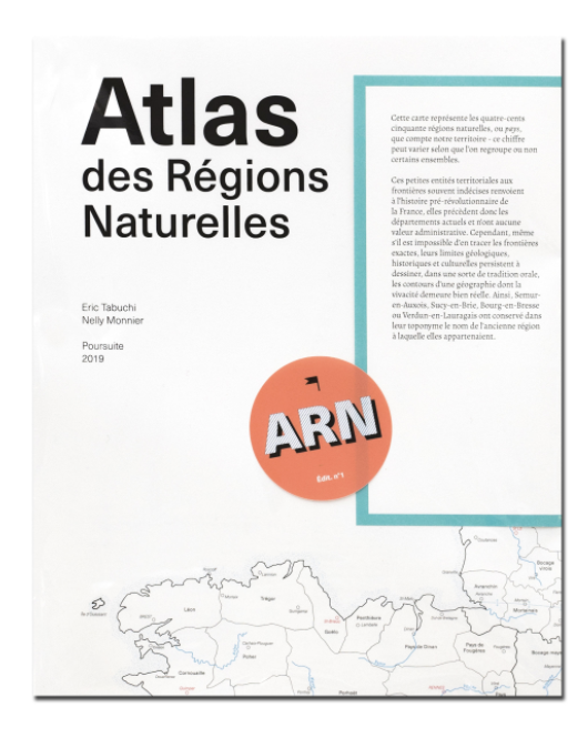
This map represents the four hundred and fifty natural regions of France, small territorial entities with often indecisive borders, refer to pre-revolutionary history, they therefore precede the current departments and have no administrative value. However, even if it is impossible to draw the exact boundaries, their geological, historical and cultural limits persist in drawing, in a sort of oral tradition, the outlines of a geography whose liveliness remains very real. Thus, Semur-en-Auxois, Sucy-en-Brie, Bourg-en-Bresse or Verdun-en-Lauragais have retained in their toponym the name of the old region to which they belonged.
After experiments, the web that these countries weave, due to their small size, their own geological characteristics but also the emotional relationship that it is possible to maintain with each of them, has turned out to be the most appropriate. to the realization of such a project. This map, which delimits them over the entire French territory, therefore constitutes the reference document of the ARN.
| Publisher | self-published |
|---|---|
| Edition | 1st edition |
| Release Date | 2019 |
| Credits |
Writer:
Artist:
|
| Identifiers |
ISBN-13:
978-2-490140-18-3
|
| Original Price | 30.00 EUR |
| Work | |
|---|---|
| Subform | |
| Topics | Environmental, France, Landscapes |
| Methods | Photography, Writing |
| Language | English |
| Object | |
|---|---|
| Dimensions | 67.0 × 84.0 cm |
| Interior | |
|---|---|
| Pages | 1 |